Abandoned & Little-Known Airfields: California, Eastern Riverside County
Rice Army Airfield / Rice Airport, Rice, CA
34.07, -114.82 (East of Los Angeles, CA)
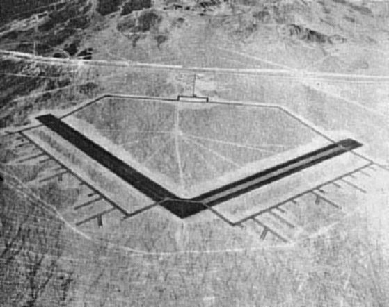
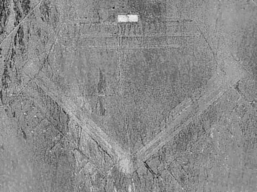
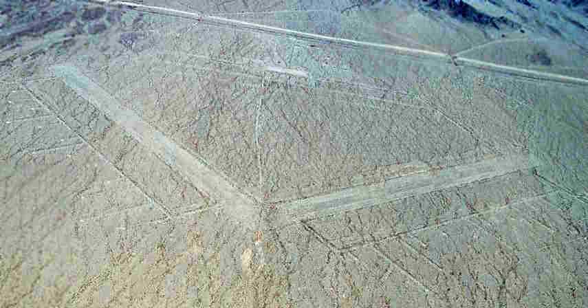
A 1942 aerial view looking north at Rice AAF (courtesy San Bernardino County Library, via Rick Jackson, enhanced by Bill Grasha).
No airfield in Rice was yet depicted on the LA Sectional Charts from 1932 through April 1942.
According to the book "The Desert Training Center/CA-AZ Maneuver Area, 1942-44" (via Rick Jackson),
the "Rice Municipal Airport" was acquired by the Army's IV Air Support Command in 1942, and was operational by 1942.
This presumably means that it existed before WW2 as a civil airport.
Rice Army Airfield was a subbase of Thermal Army Airfield.
The airfield consisted of 2 paved 5,000' runways & numerous dispersal pads extending off the runways to the south.
In order to house the more than 3,000 men, the Army constructed barracks & dormitories.
Rice AAF was described in the 1944 US Army/Navy Directory of Airfields (courtesy of Ken Mercer) as having 5,500' runways.
The earliest aeronautical chart depiction which has been located of Rice AAF was on the February 1944 LA Sectional Chart,
which depicted Rice AAF as a military airfield.
By 1944, the airfield was assigned to March Field as a subbase.
According to a history of the 4th Air Force (courtesy of Francis Blake), operations at Rice Field were ended by 8/2/44,
and the field was declared surplus on 10/31/44.
A 6/25/48 USGS aerial view (enhanced by Bill Grasha) showed the extensive facilities of Rice AAF evidently abandoned.
The Rice airfield was not depicted at all on the February 1949 LA Sectional Chart (according to Chris Kennedy).
Apparently, the Rice airfield was reused starting at some point in 1949 as a civilian airport,
as that is how it was depicted on the 1949 Gila River World Aeronautical Chart (courtesy of Donald Felton).
Rice was described as having a 6,100' hard-surface runway.
Bob Howe reported, "My grandfather ran a small flight school there. After WW2 he (the Revered Gilbert Howe) taught missionaries to fly.
I found out about Rice Field while listening to an old recording. In this tape, he mentioned taking over a hangar from the military."
Rice was depicted as an active public-use airfield on the March 1952 San Diego Sectional Chart (courtesy of Chris Kennedy).
The chart depicted Rice as having a 5,000' paved runway.
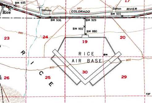
The 1954 USGS topo map depicted Rice Air Base as having 2 paved runways, taxiways, and a ramp.
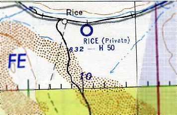
The status of the Rice airfield evidently changed to a private airfield at some point between 1952-55,
as that is how it was depicted on the September 1955 San Diego Sectional Chart (courtesy of Chris Kennedy).
The Rice Airport was evidently abandoned (for reasons unknown) at some point between 1955-58,
as it was no longer depicted at all on the March 1958 LA Sectional Chart (according to Chris Kennedy).
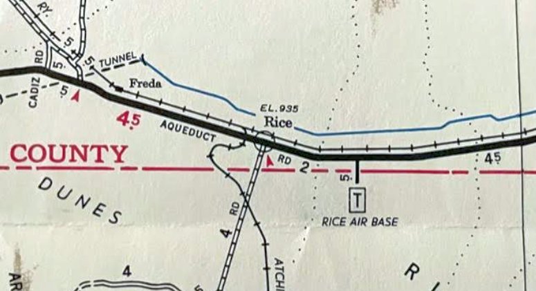
“Rice Air Base”, as depicted on a 1967 road map (courtesy of Kevin Walsh).
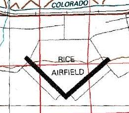
The 1980 USGS topo map depicted Rice Airfield as having 2 paved runways & parallel taxiways.
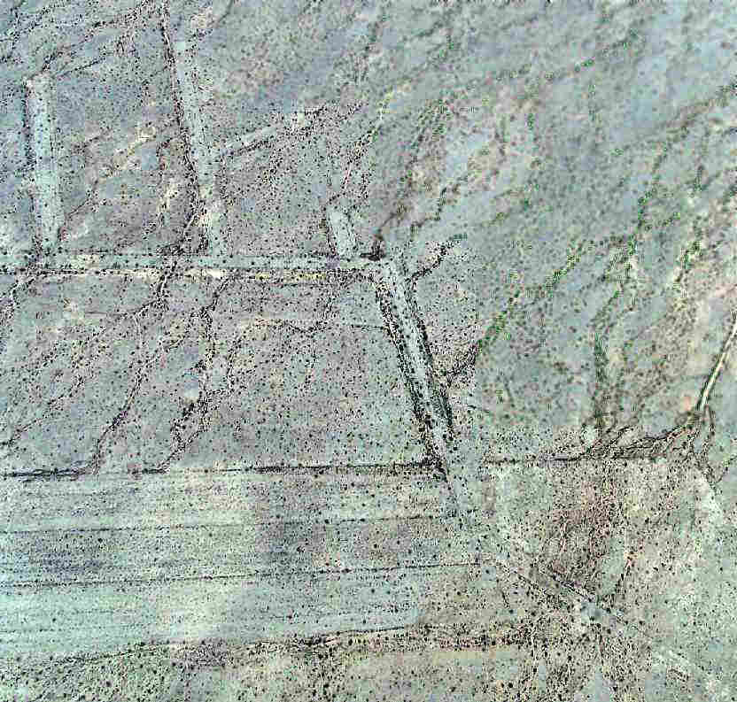
A 1996 USGS aerial photo (enhanced by Bill Grasha) showed Rice's ramp, runways & dispersal pads as barely discernible,
due to the low contrast between the airfield pavement & that of the surrounding desert.
The Rice airfield was depicted as an abandoned airfield on the 1998 World Aeronautical Chart.
Michael Grube visited the site of Rice in 2002.
He reports, "I circled the perimeter of the field & the only concrete leftover is a large pad in the north.
The rest is nothing more than desert gravel with only fewer tumbleweeds than the rest.
There are no signs that the runways have ever been paved at all. No buildings or other structures remained."
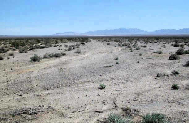
A 2003 photo by Chris Kennedy (enhanced by Bill Grasha) looking southeast at the abandoned NW/SE runway at Rice.
Chris reported that "the Rice airfield is in even worse shape, at least the runways.
Strangely, the taxiways & parking areas are in much better shape.
The parking pads, which are at the end of the short extensions off of the main taxiways appear to be concrete.
The taxiways seem to have once been oil over gravel & are easily discernible
The picture of one of the runways shows that it just looks like a road across the desert.
I did see the remains of some white paint at the end of one of them that might have been a runway number at one time.
The are some old foundations & a very large concrete parking ramp."
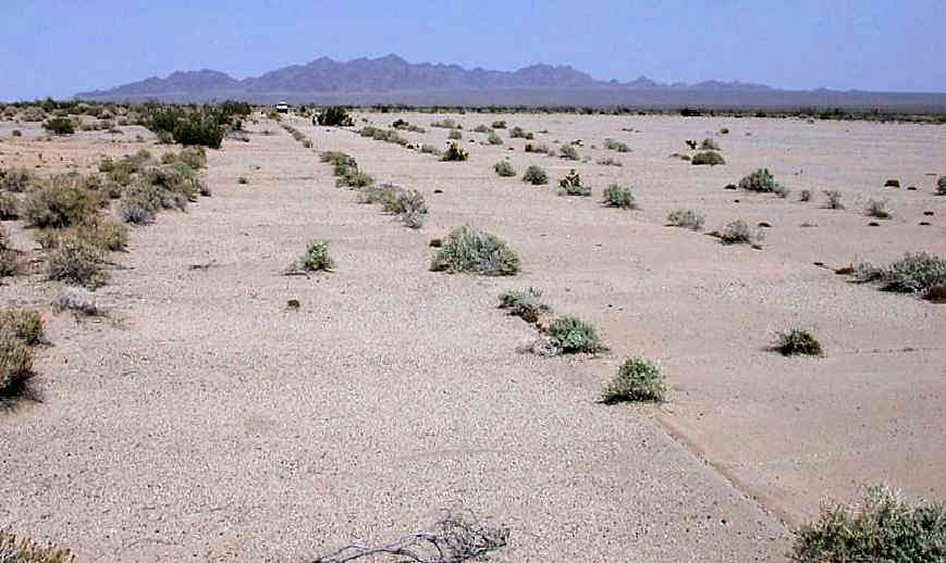
A 2003 photo by Don Barrett (enhanced by Bill Grasha) of the remains of the concrete parking pad
(which also still contained metal tie-down rings embedded in the concrete) at Rice.
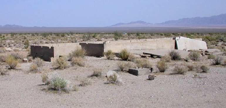
A 2003 photo by Don Barrett of the remains of a building foundation at Rice.
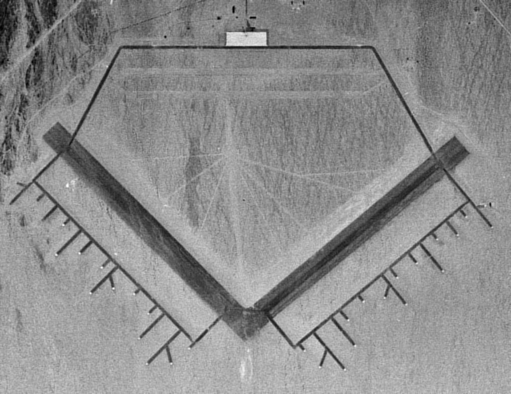
A 2006 aerial photo by Joe Merkert (enhanced by Bill Grasha) looking north at the remains of Rice AAF.
A 2006 aerial photo by Joe Merkert (enhanced by Bill Grasha) of the southern point of the “V” where the 2 runways intersected,
showing the pads used for aircraft tiedowns.
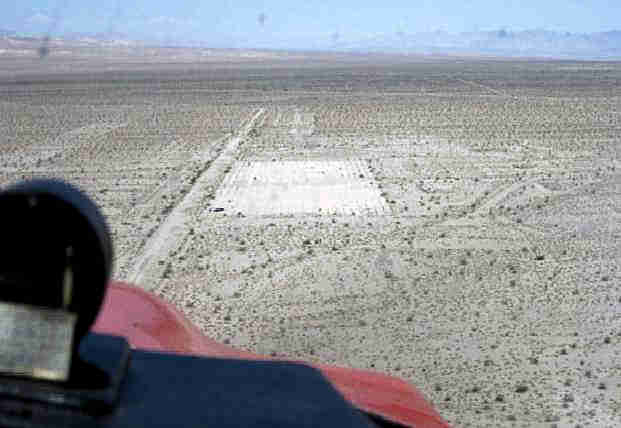
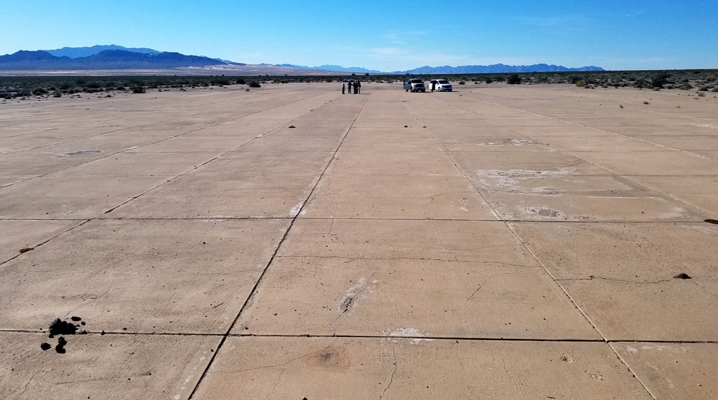
A June 2009 aerial view by Woodrow Anselen (enhanced by Bill Grasha) looking west on final approach to the Rice AAF ramp.
Woodrow reported, “Rice AAF looks pretty much the same as it did in the 2003 pictures.
Although the large runways are clearly visible from altitude, as one descends right into their vicinity,
they tend to blend in with the surrounding desert.
Down very low, I observed that they were really in poor shape & covered with lots of desert scrub bushes.
I probably could have made a landing, but opted instead for a touchdown on the concrete pad at the northern portion of the base.
This is not an overly large landing area (probably under 1,000') but what debris were on it were easily missed.”
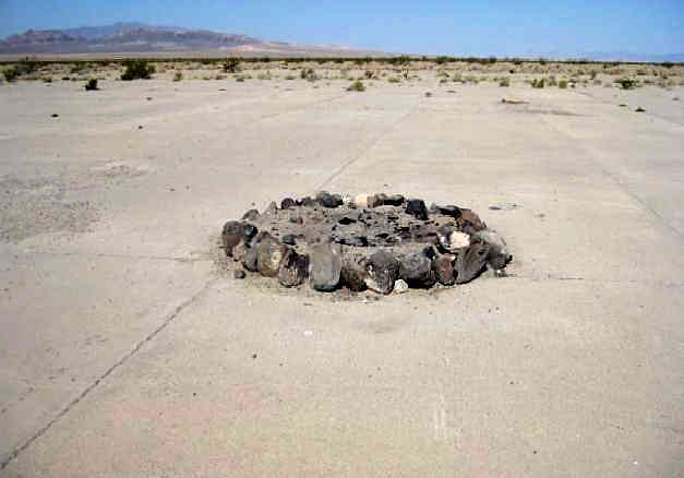
A June 2009 photo by Woodrow Anselen (enhanced by Bill Grasha) of a fire pit on the Rice AAF ramp.
Woodrow reported, “From what I could determine, this area has been used as some kind of makeshift campground as I saw several ad hoc fire pits.”
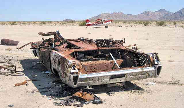
A June 2009 photo by Woodrow Anselen (enhanced by Bill Grasha) of the remains of a full-size 1965 Mercury on the Rice AAF ramp, with his Scout in the background.
Woodrow reported, “There is the remains of an automobile on this pad,
and over the years, some one has put an awful lot of bullet holes into it (I admit, I added 2 or 3 more),
and there are quite a bit of spent shell casings scattered about.”
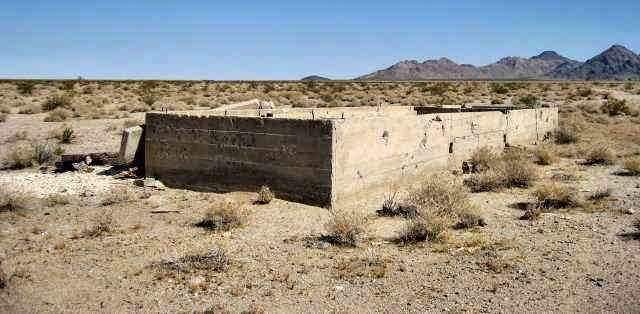
A June 2009 photo by Woodrow Anselen (enhanced by Bill Grasha) of a foundation at the site of Rice AAF.
Jim Hottois reported in 2011, “Rice AAF / Rice Airport is slated to be the site of a very large solar energy plant which will completely use up the site.
The plant will use mirrors focusing sunlight on a large ball atop a several hundred foot high tower.
The sunlight will heat liquid salt which then will pass through heat exchanger to produce steam to run turbines.
It is an interesting technology because the liquid salt will hold its heat for 2-3 days.
The last I heard about it (last week), the project does not have all of the funding in place.”
A 2/4/17 photo by Sean Eckstein of the Rice Airport tarmac.
Sean reported, “There still is an old car on the southwest corner, and some fire pits made from the local rocks at the east end.”
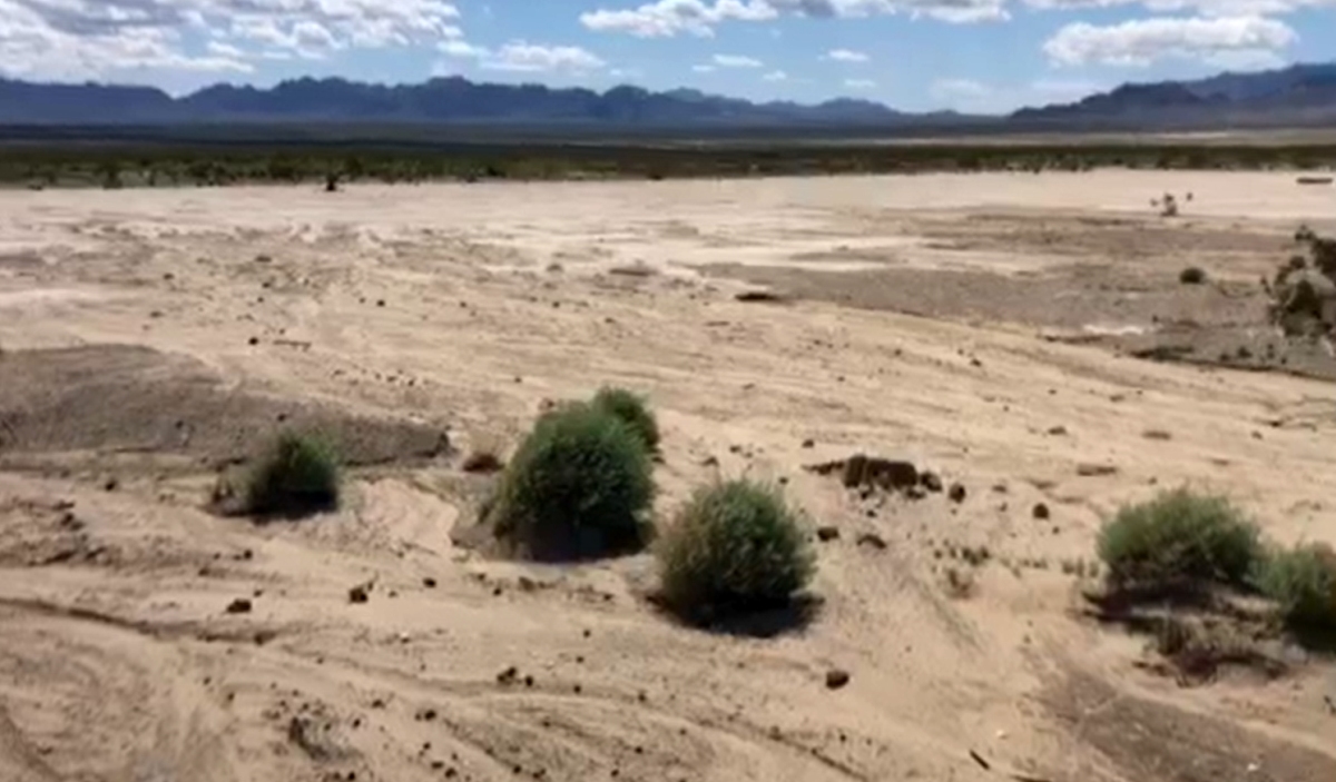
A still from a 3/23/20 video by Dick Welsh of the remains of Rice Airport.
Thanks to Mel Shettle for pointing out this airfield.
Source: Local reference page captured from Paul Freeman, Abandoned & Little-Known Airfields: California: Eastern Riverside County, Rice AAF / Rice Airport section. Original source URL: https://www.airfields-freeman.com/CA/Airfields_CA_Riverside_E.htm#rice. Captured for local service on April 19, 2026.