DTC Sky Trail aeronautical chart with course depicted
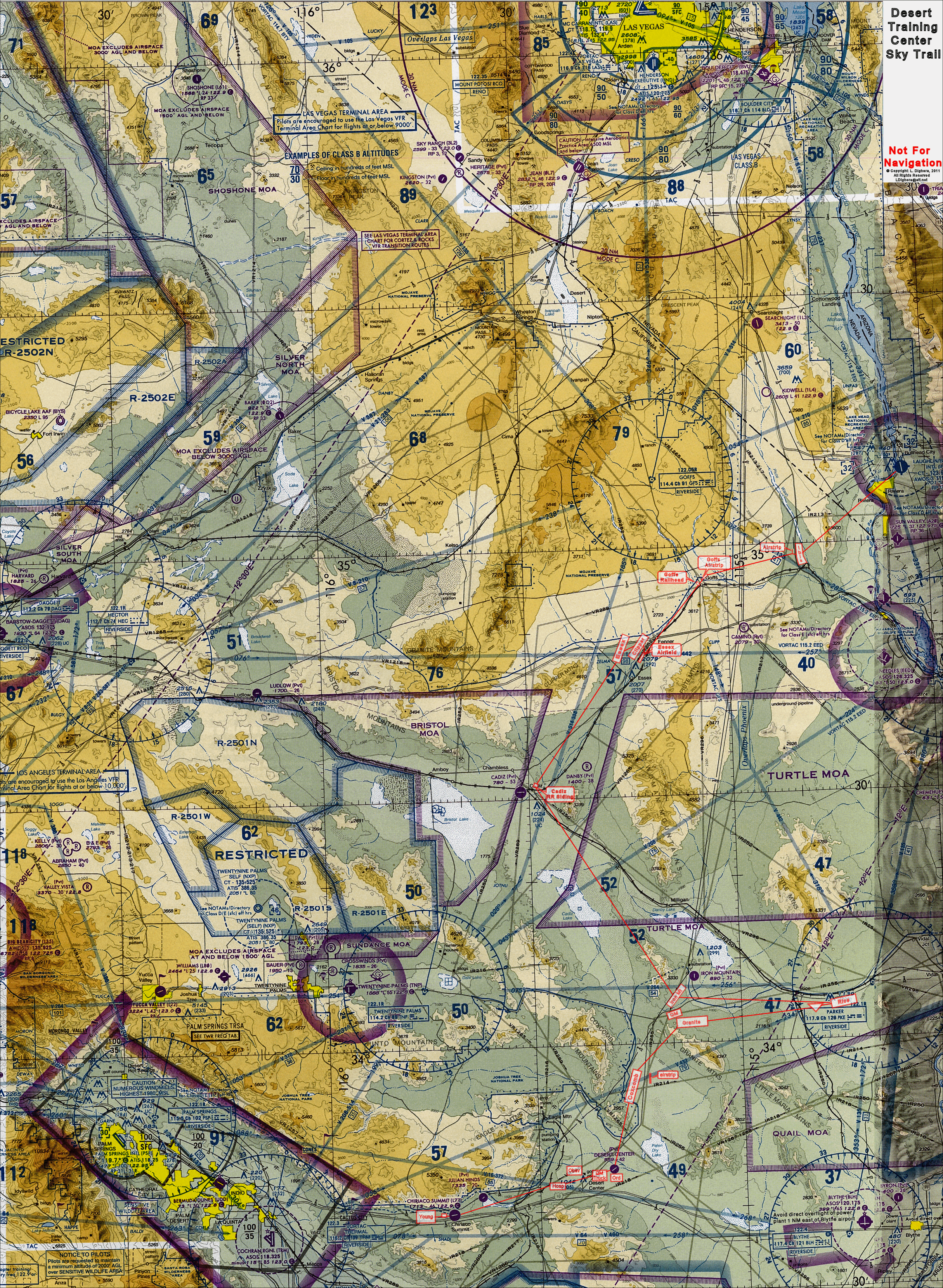
Click the chart on the right to view a full-size image, so that you can see the course information clearly. You can download the chart to your computer by right-clicking the image, and selecting Save Target As (Save Link As in Google Chrome or Mozilla Firefox browsers) on the drop-down context menu. Use this chart and the waypoints to assist you in plotting the course of your flight along the DTC Sky Trail.
Printing the chart full-size on multiple pages:
Adobe Acrobat Reader provides the facility to print the chart as a mosaic of several pages resulting in a legible and useful depiction of the DTC Sky Trail.
Download DTC_SkyTrailChart.pdf 10.2 MB (10,700,879 bytes)
Download Adobe Acrobat Reader
Legacy DUATS route file
Download legacy Cirrus / DUATS DTC Sky Trail route file
The original DUATS ecosystem is obsolete. This route file is retained as a historical artifact for local reference only.
A more detailed, textural, route of flight is available on the Route page.
Historical Aeronautical Charts
- Library Of Congress
- Sectional Chart Los Angeles, CA - April 1942
- Sectional Chart Los Angeles, CA - March 1945
- AAF WORLD AERONAUTICAL CHART (WAC) - May 1945 Mojave Desert