DTC Camps
The camps listed below are not found on the pull-down menus above under DTC History/Facilities.
Campsites
Campsites relate to a broad range of activities. Temporary camps were made for various activities, including bivouacs and maneuvers. Campsites were also used for temporary staging activities for a given unit while awaiting orders to move to a more permanent duty station. They were often made adjacent to railroad sidings, while the unit waited to embark for a divisional camp. Some of the reported campsites include the 18th Ordnance campsite, Cadiz, and those at Calipatria, Coachella, 1,000 Palms, Goffs, Needles, and Wiley's Well.
Detailed Sky Trail pages: Camp Young, Camp Desert Center, Camp Essex, Camp Clipper, Camp Iron Mountain, Camp Granite, Camp Coxcomb, Camp Ibis, Camp Rice, and Goffs.
Railroad Sidings & Support Camps
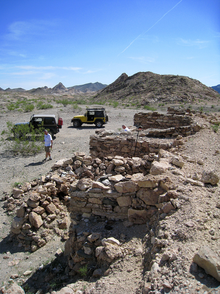
18th Ordnance Campsite
Located 5 miles east of Desert Center, this camp appeared to be a watering point and supply depot. The 18th Ordnance Battalion operated here to support the maintenance of the heavy armor training in the valley. Structures included a capped well, a 50,000-gallon water tank, and a wooden tower. No remains of this camp could be found, although its exact location is not currently known. Tent stakes and other refuse have been found in an area that relate to this camp.
Related page: Camp Desert Center includes the area map showing the evacuation hospital, observers' camp, quartermaster truck company, and 18th Ordnance Battalion.
Wiley's Well
Wiley's Well was a critical water source used as a campsite and maneuver area. During maneuvers in 1943, the signal company's pigeon detachment famously set up a "false camp" at Wiley's Well, fooling the opposing side into thinking that there was a full headquarters at the camp. Today, the WWII structures are gone, and the area is an unimproved BLM campsite with pit toilets and nonpotable water. The well itself is still in place. Areas of tank tracks can be found in the desert surrounding the camp, which may contain further evidence of military activities that took place near Wiley's Well.
The California State Military Museum identifies Wiley Wells as part of the Desert Training Center/California-Arizona Maneuver Area and reports that on 11 September 1943 the War Department acquired 480.43 acres there through permits. That source places Wiley Wells within the same broader California maneuver-ground network that supported the DTC camps and sidings listed on this page.
Source: California State Military Museum: Wiley Wells Training Area
Danby
Danby served as the headquarters for the 691st Quartermaster Laundry Battalion. In the heat of the desert, laundry was a major logistical operation; the Army leased 1,253 feet of spur track here to support the facility.
Fenner
Located immediately west of Goffs, Fenner was the primary railhead supplying Camp Essex. It contained a large warehouse (96 by 40 feet) and a vital water point used to fill the tanker trucks that watered the massive dirt runways at Essex Airfield.
Related pages: Camp Essex and Essex Airfield.
Freda
Freda was a major Quartermaster Depot for the central DTC. It contained multiple sidings where tanks and artillery were offloaded. Concrete foundations inscribed with "10/19/42" remain today, along with rock insignias of the 378th Engineer Battalion and the 211th Quartermaster Gas Supply Battalion.
Glamis
Glamis served as a rail siding with 1,000 feet of spur track. Today, the area is heavily impacted by off-road vehicle use, making it difficult to distinguish wartime tank tracks from modern recreation trails.
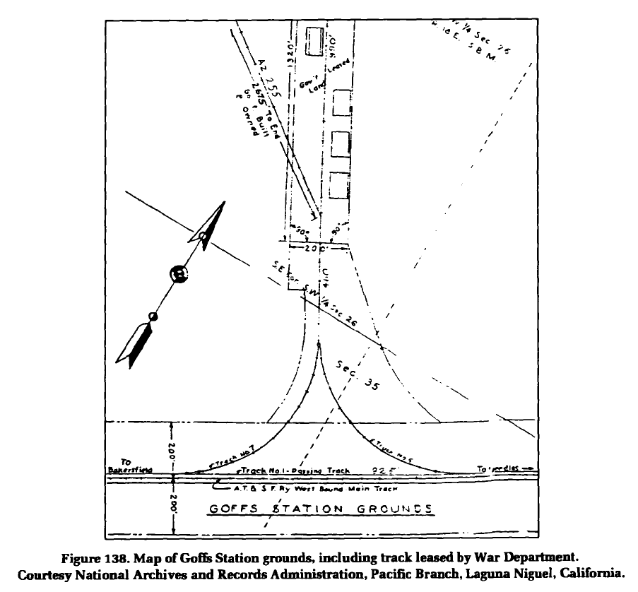
Goffs
Goffs was a major hub, featuring a campsite, ammunition storage, and a 2,600-foot rail siding. It served as the temporary home of the 7th Infantry Division in 1942. Remains include foundations of three large administration buildings and ten ammunition storage igloos near Goffs Butte.
Bronze Marker: Erected 2008 by Billy Holcomb Chapter E Clampus Vitus.
Related page: Detailed Goffs page covers the railhead, airstrips, and ammunition igloos in greater depth.
Ogilby
Ogilby served as the railhead for Camp Pilot Knob. The Southern Pacific Railroad leased 850 feet of spur track to the Army to offload troops and heavy equipment for the camp located just to the south.
Other Locations of Interest
King's Throne
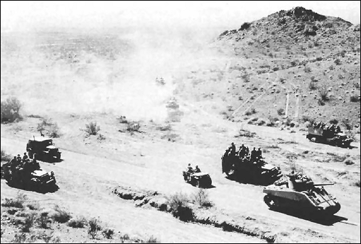
A 100-foot-tall hill located in the valley between the Chuckwalla and Orocopia Mountains. General Patton used this vantage point to observe the movements of his armored troops during live-fire exercises in the valley below.
Palen Pass
(Coordinates: 33°55'2"N 115°3'48"W)
The site of the largest maneuvers during the life of the DTC, Palen Pass was heavily fortified with gun emplacements, bunkers, and minefields for training. "First came the airplanes and strafed hell out of it... then the artillery... then tanks rumbling into the pass."
Related pages: Camp Granite and Camp Coxcomb preserve the adjoining maneuver-ground context.
Arizona Maneuver Area (Area B)
Camp Hyder
Located near Dateland, AZ, Camp Hyder was the training home of the 77th Infantry Division and the 369th Engineer Regiment. It served as a key communications and staging hub for the Arizona maneuver area. While few structures remain, the layout of the regimental streets is still visible from the air.
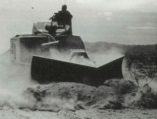
Camp Bouse (The Secret Camp)
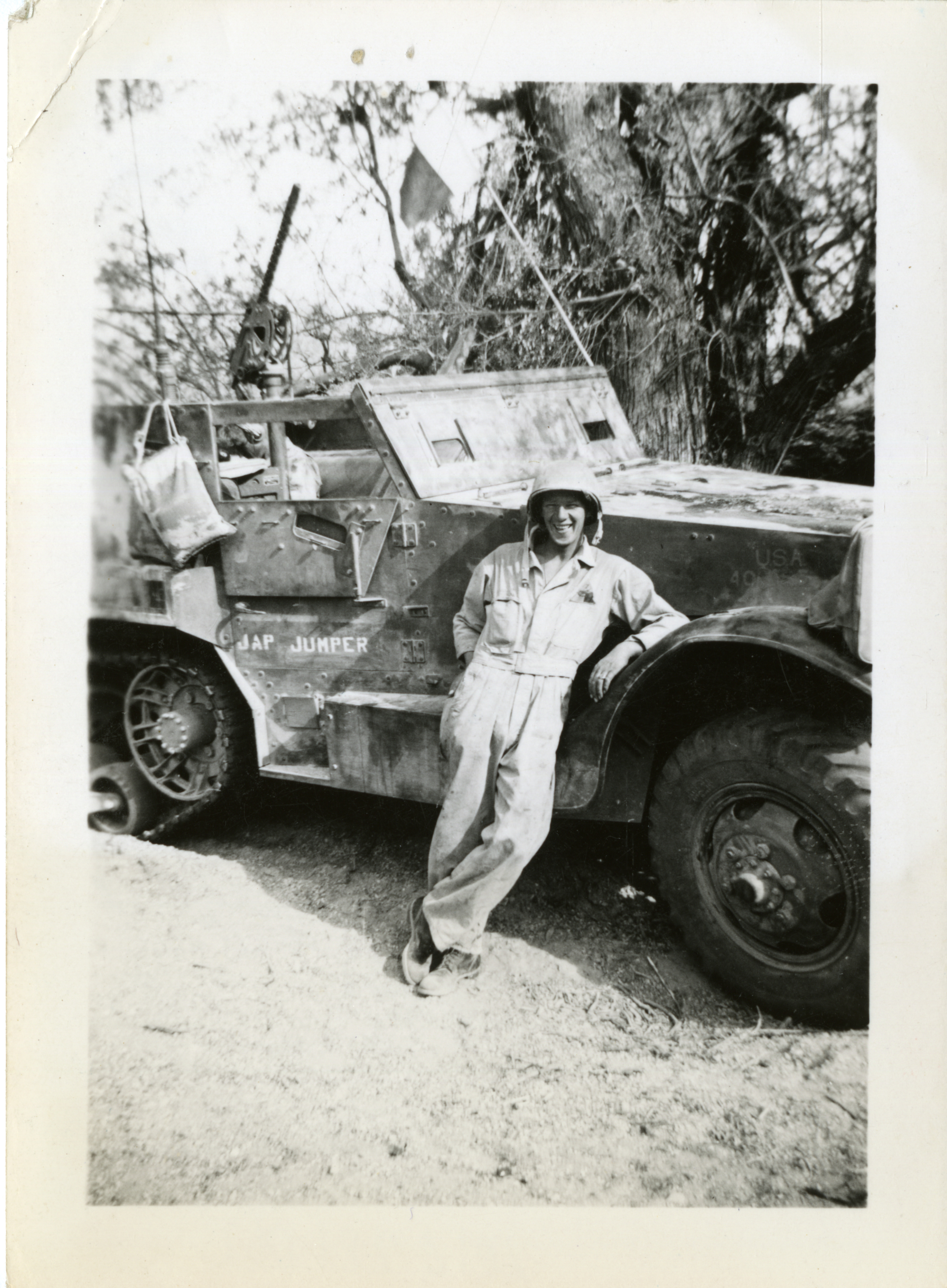
Camp Bouse was the most secretive facility in the DTC. Hidden in the Butler Valley, it was home to the 9th Tank Group and the top-secret "Canal Defense Light" (CDL) project.
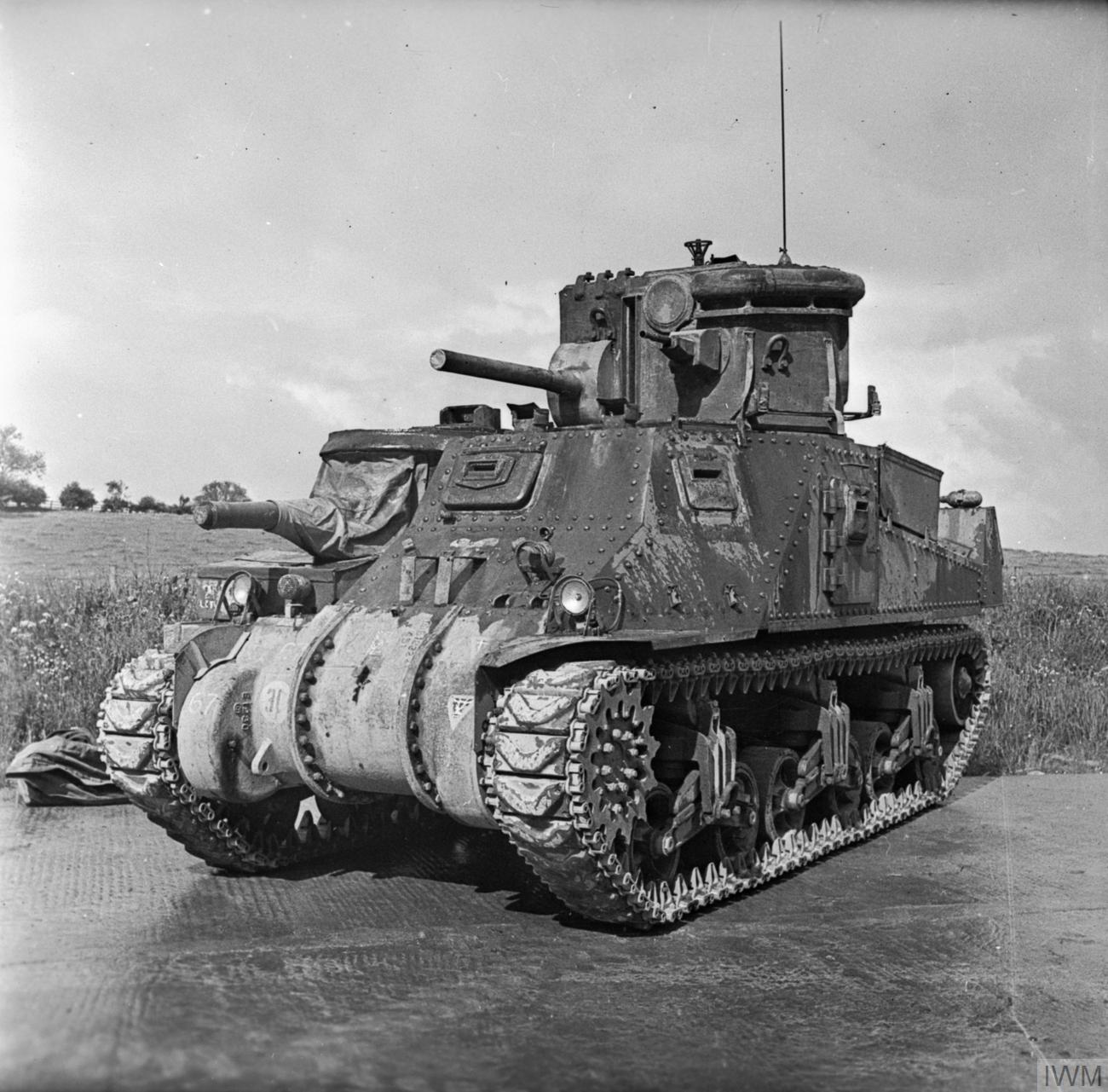
The CDL was a 13-million candlepower arc searchlight mounted inside the turret of an M3 Lee tank. It was designed to blind and disorient enemy troops during night attacks. The project was so classified that troops at Bouse were forbidden from transferring to other units to prevent leaks.
Camp Laguna
Located at the modern-day Yuma Proving Ground, Camp Laguna housed the 3rd Armored Division and later the 9th Armored. It was unique for its proximity to the Colorado River, allowing for bridge-building and river-crossing training operations.
Support & Staging Areas (California)
Camp Anza
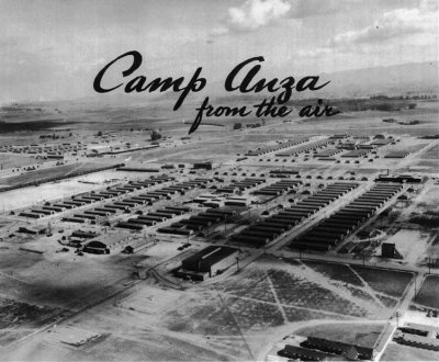
Located in Riverside (now the Arlanza neighborhood), Camp Anza was the primary staging area for the Los Angeles Port of Embarkation. Over 600,000 soldiers passed through Anza for final processing before boarding ships to the Pacific Theater. It was the "last stop" for many before the war.
Camp Haan (March AFB)
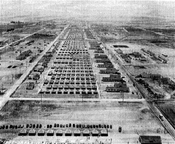
Located directly across the highway from March Field, Camp Haan was the West Coast's primary Anti-Aircraft Artillery (AAA) training center. At its peak, it housed 80,000 people, including a prisoner of war camp for 1,200 Italians and later German POWs.
Palm Springs Army Airfield
The Army Air Force utilized Palm Springs for the Air Transport Command. Today, the Palm Springs Air Museum preserves this aviation heritage.
Other Strategic Sites
- Banning: 1,000-bed General Hospital, later Naval Convalescent Hospital.
- Needles: Municipal airport used as an auxiliary field for March Field and the California-Arizona Maneuver Area.
- Pomona: Ordnance base and station hospital; see the Pomona Park Avenue Armory.
- San Bernardino: Base General Depot and communications headquarters; see also the Norton Air Force Base history.
- Spadra: General hospital support near Pomona.
- Daggett: Douglas Aircraft Modification Center.
Banning General Hospital
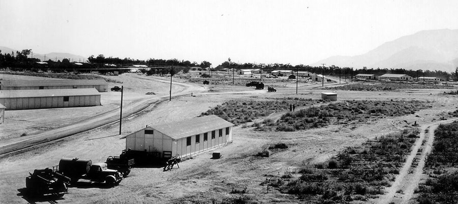
Banning supported the California-Arizona Maneuver Area with a 1,000-bed hospital complex on a 100-acre leased site in the city of Banning, bounded by Wilson Street, Jacinto View Road, Omar Street, and Sunset Avenue.
The archived Corps of Engineers INPR and the California State Military Museum summary indicate that the hospital was built between 1942 and 1943 by the 1st Battalion, 369th Engineer Regiment and operated by the 297th Field Hospital. The documented buildout included 34 wards, officers' and nurses' quarters, 13 enlisted barracks, a clinic and surgical building, administration and laboratory buildings, patient receiving and evacuation, an infirmary, bath and disinfection, three mess halls, four recreation buildings, a post exchange, morgue, guard house, fire station, engineer shop, laundry, and a 12,000-gallon water tower.
The museum's construction narrative adds useful timing: the 369th Engineers were ordered to establish the Banning project in late July 1943, moved in on August 6, 1943, and accelerated the job so the major construction was complete by October 9, 1943, with the hospital in operation by October 15.
Banning also served as the initial headquarters of the Communications Zone and included not only the 1,000-bed general hospital, but also a landing strip, an aid station, and a range.[2]
On July 6, 1944, the Army transferred the installation to the Navy for use as the Naval Convalescent Hospital, Banning. By 1948 the site had been declared surplus, the structures were removed, and the land was returned to private owners. Today the former hospital footprint is covered by residential development, a mobile-home park, an apartment complex, a church, and a fire station, with no visible military fabric reported in the 1990s survey.
Sources: California State Military Museum: Banning General Hospital; supplemented by the archived Corps of Engineers INPR copy preserved in the Sky Trail research archive.
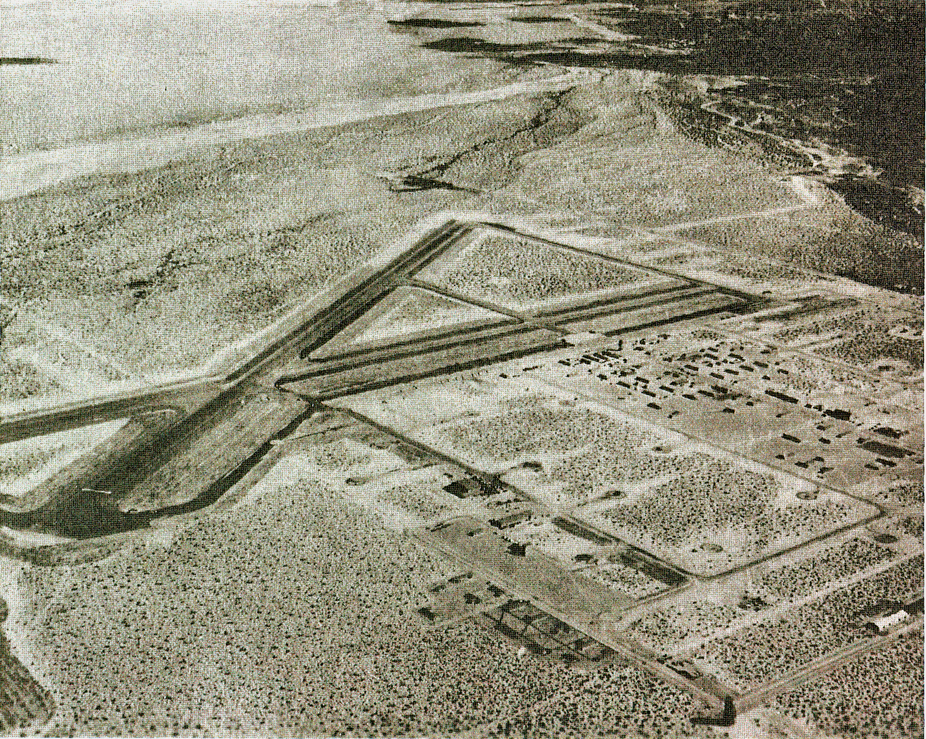
Needles Airport
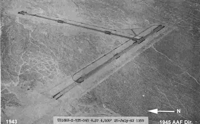
Located 5.5 miles south of Needles, the municipal airport was used by the Army to support training throughout the California-Arizona Maneuver Area and also served as an auxiliary field for March Field. By January 1945 it had been returned to civil use as Needles Municipal Airport.
The 800-acre field began as a 1933 WPA airport. During the war the Army expanded the runways and added an administration office, radio station, and small shed, and later survey literature also reported two 250-bed station hospitals, an evacuation hospital, and an aid station associated with the Needles divisional-camp area, although their exact locations were not confirmed.[2]
Source: California State Military Museum: Needles Army Air Field
Daggett: Douglas Aircraft Modification Center
Daggett was the site of Douglas Aircraft's wartime Modification Center No. 1, where aircraft including the A-20, F-3, C-47, and P-51 were brought up to current combat configuration at Barstow-Daggett Airport.[3]
Historic engineering documentation also identifies four specialized hangar sheds there that could handle the noses of as many as 36 aircraft at one time, underscoring Daggett's role as a large-scale aircraft modification site rather than a maneuver-ground camp.[3]
San Bernardino Army Air Field and Depot
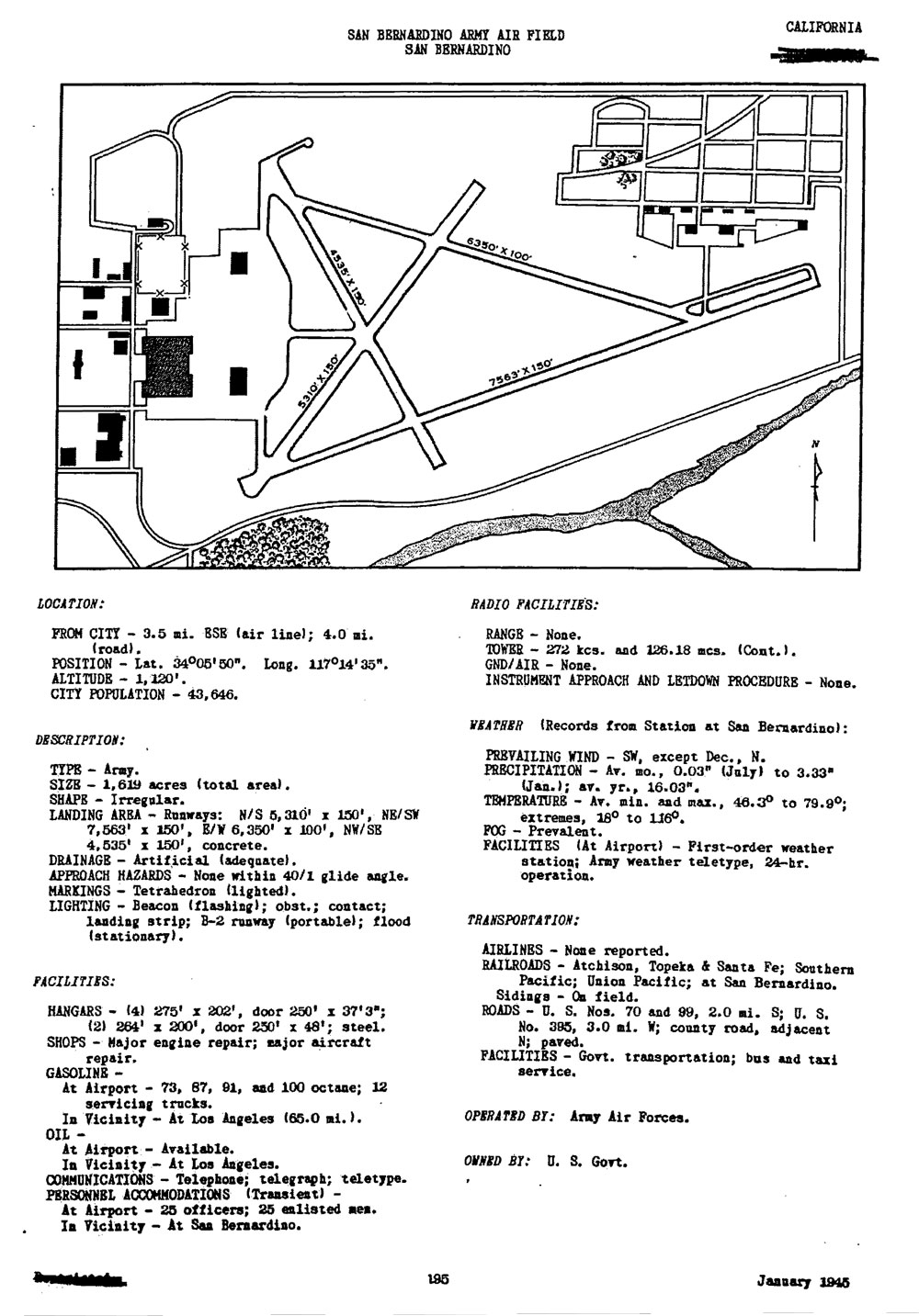
San Bernardino supported the wartime logistics network with a base general depot and the nearby Army air field whose postwar history continued as Norton Field and later Norton Air Force Base.
The Base General Depot in the San Bernardino area, also known as the Advance Communications Zone Depot, the San Bernardino Engineer Depot, and Camp Ono, was the largest depot in the network. It supplied everything except ammunition, ordnance, and Army Air Forces technical supplies, trained supply units, and became headquarters of the Communications Zone on November 10, 1943.[2]
The California State Military Museum's Norton history provides useful continuity between the wartime San Bernardino installation mentioned here and the better-known postwar air base that followed on the same ground.
Source: California State Military Museum: Norton Air Force Base
Pomona Support Sites
Pomona sat on the western edge of the Desert Training Center communications system and supported it with both ordnance and hospital functions, even though the exact wartime footprints are harder to identify today than the better-documented Banning and San Bernardino sites.
The 369th Engineer Regiment history states that Company F built a station hospital at Pomona during the same summer 1943 work cycle that sent other companies to Bouse, Spadra, and Banning. That same history records Company F returning from Pomona in September 1943 to help accelerate completion of Banning General Hospital.
Pomona also functioned as a western support node with a station hospital, post office, replacement depot, and ordnance base, the latter established at the fairgrounds.[2]
The surviving Park Avenue Armory is not presented here as the DTC station-hospital site itself, but it does preserve Pomona's broader wartime military landscape and offers a visible local anchor for the city's support role.
Sources: Army Corps of Engineers Virtual Museum: 369th Engineer Regiment (SS); California State Military Museum: Pomona Armories
Spadra General Hospital
Spadra, near Pomona, served as a major general hospital location for the Desert Training Center medical network. The 369th Engineer Regiment history records Company E completing the general hospital there before returning to help meet the accelerated Banning deadline.
A separate 34th General Hospital history provides the clearest operational picture: the unit moved to Spadra in September 1943 to take over the 13th General Hospital, and by September 11, 1943 the plant was already handling a patient census of 1,640. That account says the installation provided rear-echelon treatment for roughly 100,000 troops during maneuver periods and, for a time, was the only general hospital supporting the Desert Maneuver Area force.
A 750-bed hospital was established at Spadra, although its exact location was still uncertain in the later survey literature.[2]
Regional wartime medical history also preserves the name Spadra Annex in the Corona naval-hospital system, suggesting that the Spadra medical facilities remained part of Southern California's larger wartime hospital geography even beyond the DTC's peak maneuver phase.
Sources: Army Corps of Engineers Virtual Museum: 369th Engineer Regiment (SS); WW2 US Medical Research Centre: 34th General Hospital; California State Military Museum: Naval Surface Warfare Center, Corona Division