Whether you are planning a visit from the Los Angeles area to the casinos and entertainment of Las Vegas or Laughlin, interested in military history, or just curious about the desert's secrets, you will find the views disclosed by this trail in the sky remarkable in their sweeping scope and lasting preservation.
This DTC Sky Trail is an interpretive view of our nation's 1942 response to the Japanese and Nazi military aggression of World War Two (WWII). Aerial visitors will see the rock-alignments that still define the ghostly boundaries of the twelve divisional troop training campsites, airstrips, and other facilities, virtually unchanged since being laid down eight decades ago.
Roosevelt After the Japanese Attack on Pearl Harbor
Franklin D. Roosevelt asks Congress for a declaration of war on December 8, 1941. This is the political break point that set the Desert Training Center effort in motion.
Churchill's Finest Hour
Churchill's June 1940 speech is a fitting Allied counterpart to Roosevelt's war address and belongs here at the front of the site, where the larger wartime stakes are introduced.
Speed Is Not a Tactic.
It’s a Weapon.
"Patton’s advantage was never politeness, patience, or perfect paperwork. It was tempo."
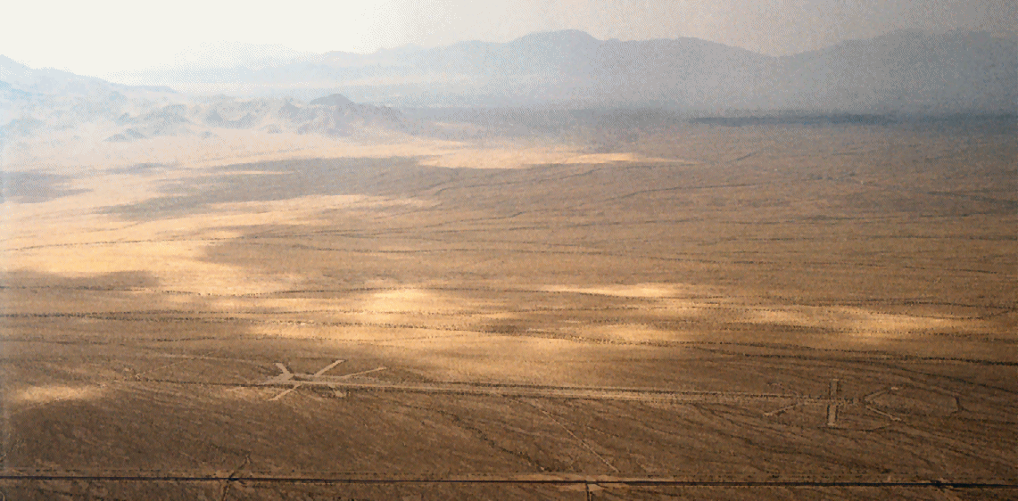
From altitude, the Mojave looks empty—until the ground resolves into intent. You see faint grids, scarred tracks, and ghost-camps drawn like pencil lines across the sand. Those aren’t random marks. They are the physical residue of a decision that changed how America learned to fight.
In 1942, Patton used these 18,000 square miles to burn hesitation out of the chain of command. The desert was his furnace. Here, comfort was removed, time was scarce, and initiative was the only currency that mattered.
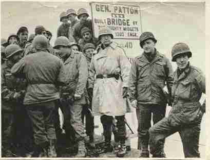
That habit of speed is what carried the Third Army across Europe. When they reached the Rhine River—the final barrier of the Reich—they didn't wait for the official plan. They improvised a bridge, crossed under darkness, and kept moving.
Fly the Sky Trail to see the primitive forge where that unrelenting momentum was manufactured.
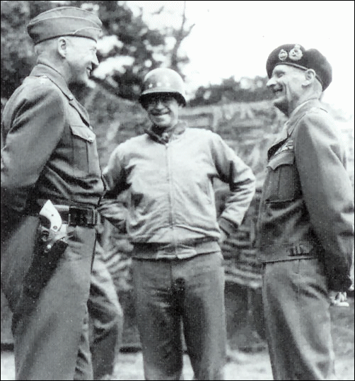
The General and the Desert
It was April, 1942 when General George S. Patton, Jr. was tasked with creating a military training facility, the Desert Training Center (DTC), to prepare U.S. Soldiers for the Allied invasion of the deserts of North Africa, Operation Torch.

Related document: With Patton on Desert Maneuvers, a locally served four-page Desert Magazine extract preserving the cover, opening spread, and continuation of the 1960 retrospective on Patton's 1942 desert training mission.
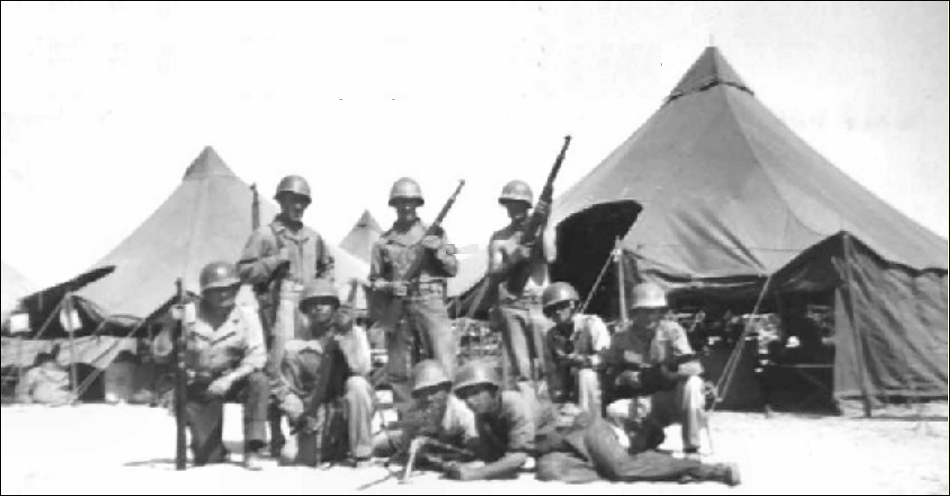
'Ole Blood and Guts' Patton, who wore ivory-handled revolvers on each hip, was a vigorous proponent of tank warfare. During the 1941 Louisiana Maneuvers, he dominated the action with daring tactics that outflanked and outclassed officers of the mock opposing forces by capturing their headquarters and commanders. Because George Patton had commanded the only American tank brigade to see action in the last World War, he was chosen to create the DTC.
A flamboyant, some might term audacious, and undeniably successful military strategist, Patton surveyed the southwest from Yuma to Searchlight with his own personal 'Flying Jeep,' a little Stinson Voyager light aircraft. Doubtless, it was the aerial vantage point offered from Patton's airplane that facilitated such a grand vision. From that vantage point, Patton looked out upon the millions of acres of uninhabited desert and stated that:

General Patton first learned to fly in an old Curtiss Jenny back in 1921. In the spring of 1942, Patton purchased 28 acres from Joseph Chiriaco for five dollars per acre and used the land as an airstrip adjacent to Camp Young.
Although General Patton sold his "Voyager" before he embarked for Casablanca, after the North African coast was secured, he had several Stinson "Flying Jeeps" shipped to him and used them in Tunisia, Sicily, and in Europe. In the fall of 1944, when his 3rd Army had run right off its tactical maps in its dazzling dash across France, it was a light plane which carried a new set of charts to the stalled columns of armor. [2]
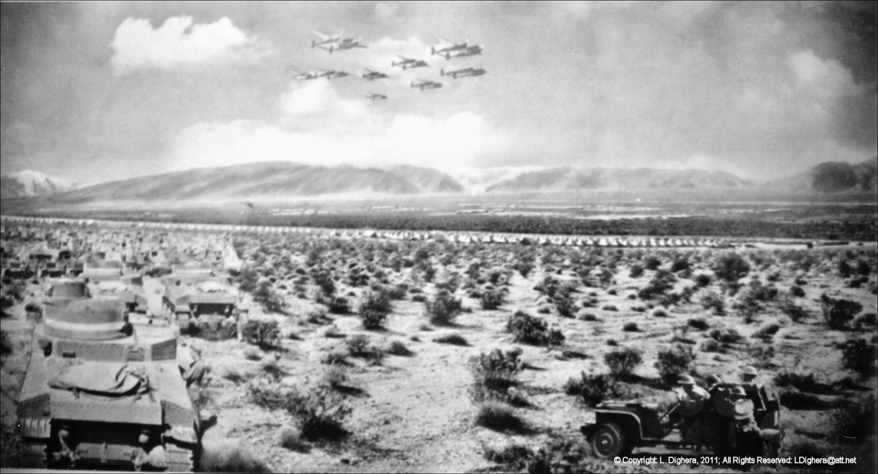
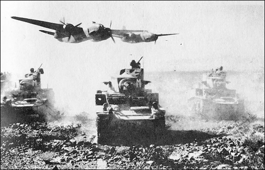
Aware that tanks require vast space to maneuver, Patton's DTC encompassed 18,000 square miles (an area about the size of the states of Vermont and New Hampshire combined), and remains today the world's largest military training facility.
A Vast Historic Landscape
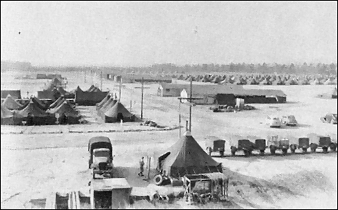
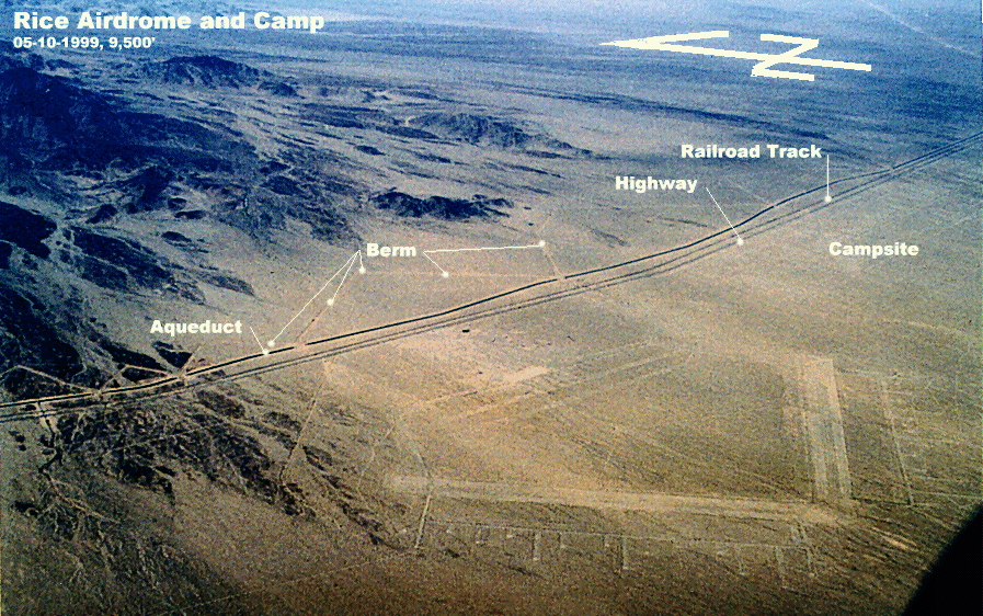
Due to the slow progress of erosion in the desert climate, significant vestiges of the twelve divisional campsites meet aerial visitors with their ghostly meticulous street layout. Each campsite was approximately one mile wide by three miles long. Even tank tracks are clearly visible today, notably in the area of Wiley's Well west of Blythe.
With its enormous size and resulting wealth of historical cultural artifacts, the DTC today shouts its presence, despite those features' minimal height and arcane aspect.
On these pages, you will find:
- An aeronautical route and flight-plan provided for the Pilot In Command (PIC) to follow.
- A docent narrative to be read by a passenger.
- Some history of the DTC.
- Some regulatory and meteorological considerations.
- Thoughts on desert survival and health considerations.
Fly the DTC Sky Trail en route between LA and the Nevada resorts, and you're sure to arrive richer for the experience. Enjoy the sights, and don't forget to report your experience.
The Sands of War
Produced in conjunction with the BLM, featuring historic footage and veteran interviews.
AOPA Sky Trail Article
Patton's desert camps, viewed from above
March 20, 2013
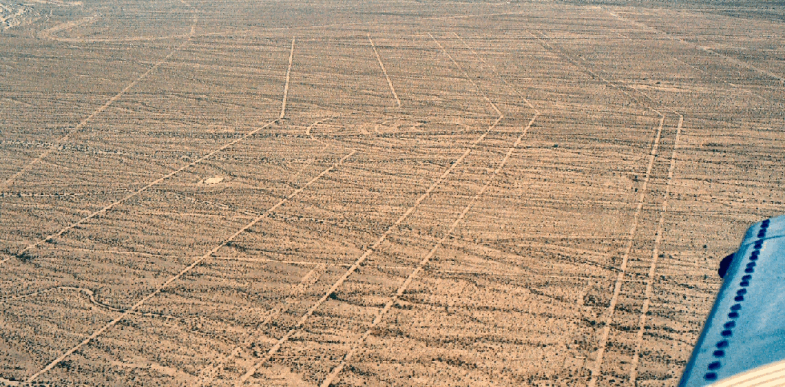
Photo courtesy Larry Dighera.
It has been a labor of love, one that Larry Dighera hopes will inspire fellow pilots to take a scenic excursion through history. Dighera, 70, worked for 16 years, off and on, compiling a pilot's guide and detailed history of the Desert Training Center created by Gen. George Patton in 1942. While the structures are gone, there remains a network of roads, airstrips, and other visible vestiges of the sprawling center, geometric lines, and circles that stretch across a vast expanse of desert in southeast California and southwest Arizona.
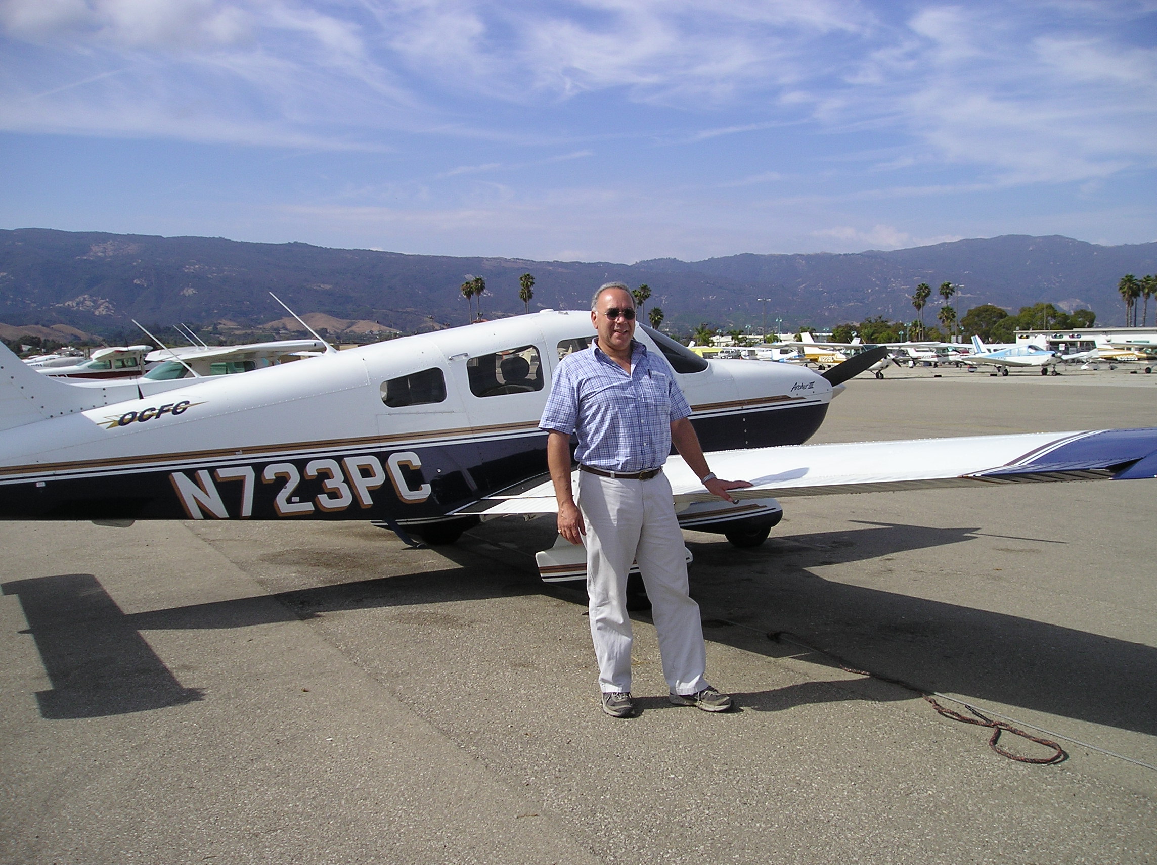
Photo courtesy Larry Dighera.
"Somebody needs to get general aviation people excited about this," Dighera said, adding that the nation is full of places that lend themselves to aerial tours. "Let's get people making these things all over the place."
Dighera collaborated with park service historians and secured a modest grant to support his online project, which includes docent scripts to be read aloud along the winding route between Laughlin/Bullhead International Airport and Chiriaco Summit Airport, home of the General Patton Memorial Museum. Dighera said the Blythe Intaglios—massive images carved centuries ago by native tribes—would make another fine sky trail of their own.
"You can really appreciate them much better from the air," Dighera said. "There should be a registry of them."

By Jim Moore
AOPA Pilot and Author covering General Aviation.
 Wolf Aviation Fund Grant Recipient
LOCATION: Mojave Desert, southern California
[2] How General Patton Flew His Jeeps by William B. Mellor, Jr.