Flight Information
Before embarking on your tour of the Desert Training Center it is imperative that you consider the meteorological, regulatory, and topographic aspects of your flight, as well as the hostile desert environment over which you will be flying. You'll find information under the DTC Sky Trail menu item in the menu-bar above. Consider also any, on or off-trail, stops you'd like to make en route such as the Patton Memorial Museum at Chiriaco Summit or Roy's Diner in Amboy. Ideally, one of the DTC airstrips (such as Essex AAF, Coxcomb airstrip, Ibis airstrip, ...) adjacent to a divisional campsite could be made serviceable, so that fly-in visitors would be able to experience a ground level view as well as the aerial perspective. While this narrative is presented from the presumption of your flight originating in the Los Angeles area and proceeding northeastward toward Laughlin or Las Vegas, of course it can also be flown in the reverse direction.
1: Camp Young (33° 40.4' N, 115° 47.0' W) Heading: 084°
As your flight approaches Chiriaco Summit Airport from the west, 3 nautical miles west of the airport you will see the street pattern of former Camp Young against the foothills north of Interstate 10. An aerial photograph is provided on the Camp Young page to assist you in orienting yourself with the Camp Young location.
2: Shaver’s (Chiriaco) Summit Airport (33° 39.9' N, 115° 42.6' W) Heading: 062°
As your flight departs Camp Young and proceeds easterly three miles through the Chuckwalla Valley, you follow the prominent Colorado River Aqueduct and electrical power transmission lines along the foothills of the Eagle Mountains north of Interstate Highway 10, you arrive at the former Shaver's Summit airstrip. Landing at Chiriaco Summit Airport (L77) and visiting the General Patton Memorial Museum (Open 0930 to 1630 daily; admission is $5.00 per person) will make your experience more complete. Announce your position and intentions on the Common Traffic Advisory Frequency (CTAF) of 122.900 MHz. There are no service facilities at the Chiriaco Summit Airport. At the museum, you'll get a good feel for what life was like for the troops who trained here and have an opportunity to see tanks and other historic artifacts. A stop here also offers an opportunity to dine at the Chiriaco Summit Cafe. After you depart and head east, past the Eagle Mountains to the north, you will see the vast expanse of the Palen Valley spreading north and east ahead. It was in this area that some of the largest maneuvers were conducted. Entire divisions practiced in mock battle against one another, operating across hundreds of miles of desert terrain.
3: Desert Center (33° 44.9'N, 115° 19.4'W) Heading: 004°
Before heading north, If you look carefully to the south just north of Interstate Highway 10 where it intersects with Eagle Mountain Road, you may be able to discern the road pattern of the Desert Center Evacuation Hospital site.
As you head north up the Palen Valley, you will soon pass the Desert Center Airport (CN64), which was anotherDTC air facility. Announce your position and intentions on the CTAF of 122.900 MHz. There were also a motor pool, observer's camp, quartermaster truck company and ordnance battalion, in addition to the evacuation hospital here, but they appear to have been covered by more contemporaneous activities.
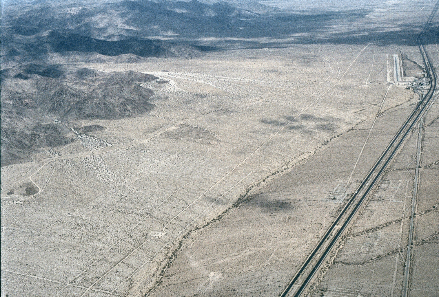
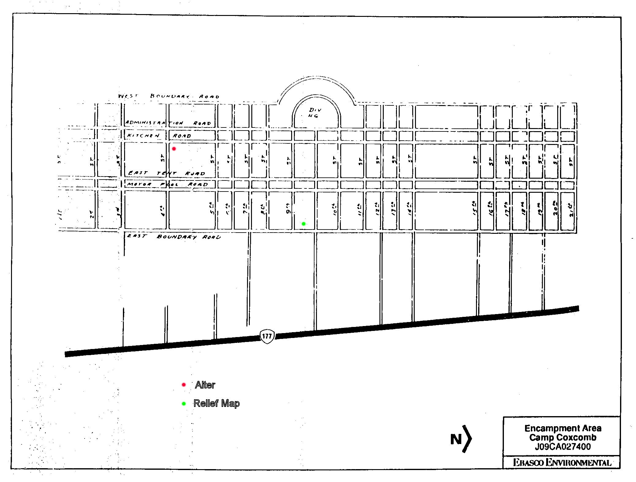
4: Camp Coxcomb (33° 54.7' N, 115° 16.4' W) Heading: 029°
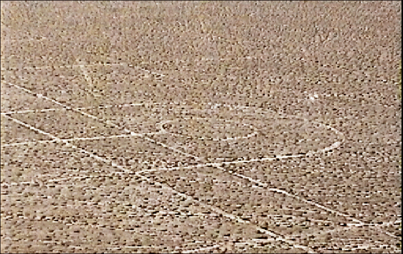
Turning north to follow California Highway 177, climb to 1300 feet MSL (600 feet AGL) as you progress up the valley from Desert Center. You will find Camp Coxcomb located west of the highway, along the eastern foothills of the Coxcomb Mountains. The camp is located about five miles north of the point where the highway makes an abrupt bend to the north. Slow down and circle the street pattern of the camp. If you look closely, you will see the relief map and alter. The 4200' long Coxcomb airstrip is located on the east side of California Highway 177 across from the northern portion of the campsite.
5: Camp Granite (34° 03.3' N, 115° 06.9' W) Heading: 075°
Continuing to follow California Highway 177 northward brings you to Camp Granite located on the northern foothills of the Granite Mountains and south of California Highway 62 and aqueduct. As you circle the street pattern, imagine this camp filled with tents, men, and vehicles. Adjacent northwest is the 484th Quartermaster Battalion campsite.
6: Camp Iron Mountain (34° 6.0' N, 115° 9.5' W) Heading: 317°
You will next come to Camp Iron Mountain, near the intersection of California Highway 177 and 62. It is located west of the aqueduct on the eastern foothills of the Iron Mountains. The camp contains clear street outlines and many rock alignments. The camp is so well-preserved that the BLM erected fencing around the majority of the camp to protect it from vehicle traffic. The camp contains two rock and cement altars, as well as the DTC/C-AMA’s largest topographical map. These can be spotted from the air, at the right altitude. This may require some experimentation.
7: Rice Army Airfield (34° 3.7' N, 114° 48.9' W) Heading: 067°
Continuing eastward along California Highway 62 to the railroad siding of Rice, and Rice Army Airfield and divisional camp, located south of the highway. Be vigilant for the 300‘ radio towers in the area.
8: Camp Rice (34° 4.6' N, 114° 45.7' W) Heading: 261°
Immediately west of Rice AAF lies Camp Rice. This was a large divisional camp whose remains are still clearly distinct. Be vigilant for the 300‘ radio towers in the area.
9: Cadiz (34° 31.2' N, 115° 30.5' W) Heading: 024°
Your flight now turns northwest following the railroad tracks and Cadiz Road for over 40 miles to the remains of a small camp at Cadiz RR siding. As you approach from the south, you will see two light colored natural gas tanks and several large, dark square vineyards to the west of the road and tracks. Just north of this point is where the railroad tracks join an east/west track. North of the railroad tracks you will find the remains of the camp at Cadiz. It consists of one rock-lined road oriented east-west, and a rectangular rock alignment adjacent to the south. You will also notice the numerous tank tracks remaining on the desert surface. From here, you may optionally choose to visit:
- Roy's Diner in Amboy (historic strip, estimated center): (34° 33.68' N 115° 44.93' W) Ground access is recommended; the strip status is unofficial/private. Visit this historic Route 66 Cafè.
- Cadiz Dunes: (34° 21.5' N 115° 23.5' W)
- Amboy Crater: (34° 32.7' N 115° 47.4' W) Great black cinder-cone rises 250 feet above the desert floor
10. Camp Clipper (N34º 45.85' / W115º 16.06') Inbound Mag Crs: 037º
Leaving Cadiz, bear right to follow the railroad tracks northeast up the valley to Camp Clipper and Camp Essex. The site of Camp Clipper is located southwest of Essex Road and northwest of the railroad tracks. It is very difficult to spot, however.
11. Essex Airfield (N34º 46.3' / W115º 13.2') Inbound Mag Crs: 079º
The airdrome adjacent to Camp Essex and Clipper is a stunning sight. At the end of each runway are twelve revetments, spaced widely apart. The pads at the end of the revetments were for the storage of aircraft carrying explosives. It was used as late as 1976. Be vigilant for the 300‘ radio tower south of the airdrome.
12. Camp Essex (N34º 47.91' / W115º 16.07') Inbound Mag Crs: 304º
To the northwest of the airfield is Camp Essex, which was bisected by the construction of I-10. Circle the street pattern of the camp and look for the remaining features. The 50,000 gallon concrete reservoir is particularly noticeable.
13. Goffs (N34º 55.1' / W115º 4.2') Inbound Mag Crs: 054º
As you continue northeast from Camp Essex toward Goffs, follow the railroad and nearby roads as visual references. Evidence of Camp Goffs is subtler than at earlier sites: look for scattered foundations, disturbed pads, and linear remnants near and east of the former rail siding rather than a complete street grid.
The triangular former Goffs Intermediate Field, east-northeast of the camp area, is the most recognizable DTC-era feature from the air. Surface condition is unimproved and unmaintained; a landing attempt is likely unsafe and may involve trespass.
Nearby Camino Airstrip (CL29), owned by Metropolitan Water District of Southern California, is private-use (dirt) and requires prior permission. If fuel status is becoming a factor, plan Needles Airport (KEED): 100LL and Jet A are generally reported available; confirm same day with Paradise Aviation at (760) 326-5263. KEED official page: https://airports.sbcounty.gov/needles-airport/. Always verify current NOTAMs and Chart Supplement data before departure.
14. Ibis Airstrip (N34º 58.54' / W114º 50.39') Inbound Mag Crs: 074º
Located across Highway 95 to the west from the camp proper are the remains of Ibis airfield, historically a single unpaved north-south strip of about 4,500 feet. Freeman and later imagery describe the strip as barely recognizable today. Treat it as a historical overflight reference, not an intended landing destination. Numerous rock-lined walkways, refuse, and a few roads can still be found in this area.
15. Camp Ibis (N34º 58.2' / W114º 49.4') Inbound Mag Crs: 038º
Continue from Ibis Airstrip toward the camp remains along U.S. Highway 95 in Piute Valley on the western foothills of the Dead Mountains. Camp Ibis has a unique bent street layout, aligned with the turn in Highway 95; none of the other DTC divisional camps share this pattern. The site remains relatively well preserved and easily recognizable from the air, with rock-lined walkways, pads, and a distinct large rectangular reservoir.
16. Laughlin (N35º 09.28' / W114º 33.56') Inbound Mag Crs: 038º, altitude: 3,500’, Cruise
Leaving the railroad, continue northeast over the Dead Mountains toward Laughlin. The descent into the Mojave Valley toward the Colorado River reveals the resort corridor along the river. Use caution for prominent obstacles in the valley, including the approximately 504-foot stack on the west bank (top of the stack is near 1,219 feet MSL).
Laughlin/Bullhead International (KIFP) lies on the east bank with Runway 16/34 (8,500 ft) roughly paralleling the river. Contact Bullhead Tower inbound on 123.9 when in service, then contact Bullhead UNICOM on 122.85 for local ramp/hotel-shuttle coordination. After landing, follow Tower/Ground instructions and airport signage to transient parking; Taxiway A5 is a common route to the west-side GA/FBO parking area on the current Airport Diagram. Arrange hotel transportation with your destination resort or FBO before arrival, as shuttle availability can change.